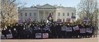
AFTF Ranked # 9 Yesterday Is Among Google's "Most Popular"
AFTF has been in the Top 100 for much of this past week and is now ranked # 51.
http://freedomtofascism.blogspot.com/
http://freedomtofascism.blogspot.com/
posted by The Freedom Fellowship at
4:00 AM
![]()
![]()


4 Comments:
This 2004 report confirms that the government uses devices like Drones to do 3D maps of areas they plan to have conflicts in, such as Ed Browns Property.
the agency merged aerial photographs and 3-D images, allowing security planners to virtually walk, drive or fly through the Simi Valley, California, route.
BETHESDA, Maryland -- In the name of homeland security, America's spy imagery agency is keeping a close eye, close to home. It's watching America.
Since the Sept. 11 attacks, about 100 employees of a little-known branch of the Defense Department called the National Geospatial-Intelligence Agency -- and some of the country's most sophisticated aerial imaging equipment -- have focused on observing what's going on in the United States.
Their work brushes up against the fine line between protecting the public and performing illegal government spying on Americans.
Roughly twice a month, the agency is called upon to help with the security of events inside the United States. Even more routinely, it is asked to help prepare imagery and related information to protect against possible attacks on critical sites.
For instance, the agency has modified basic maps of the nation's capital to highlight the location of hospitals, linking them to data on the number of beds or the burn unit in each. To secure the Ronald Reagan funeral procession,
http://www.wired.com/news/technology/0,1282,65091,00.html
Man uses free, public Wi-Fi; police seize his laptop
http://bleap.blogspot.com/
Still funny for now, but the day will come.
Kosmic:
thanks for sharing the wi-fi story!
Post a Comment
Subscribe to Post Comments [Atom]
<< Home